- Home
- Awards
HIGICC recognizes outstanding community members and students through two programs: The Mark Lierman Memorial Scholarship Award and the President's Award.
Mark Lierman* Memorial Scholarship
The Mark Lierman Memorial Scholarship is a $1,000 scholarship that recognizes deserving students who have demonstrated an appreciation for and understanding of geospatial data and geographic information systems (GIS).
Applicants must be Graduated from a high school in Hawai`i, Graduating from a high school in Hawai`i in the Award year, or be attending an accredited higher edcuation school in Hawai`i. Applicants may also be enrolled at an accredited college or university for the immediate following school year.
Scholarship Award Recipients:- 2024 No Award
- 2023 Liam Felix
- 2022 Kailey Pascoe
- 2021 Tierra Bartolotti
- 2020 Gina McGuire
- 2019 Yoko Uyehara
- 2018 Eszter Collier
- 2017 Katie Taladay
- 2016 Nick Turner and Megan Mulley
- 2015 Mapuana O'Sullivan
- 2014 Charles Devaney and Nick Yamauchi
- 2013 Abby Frasier
- 2012 Erik Franklin and Kathyrn Massaro
- 2011: Kosta Stamoulis and Elena Abe
- 2010: Christopher Hamilton
- 2009: Mele Chillingworth and Jessica Nalani Leonard
- 2008: No award
- 2007: Lisa Wedding - GIS and remote sensing applications for coral reef management
- 2006: Garrett George and Kealoha Kinney
President's Award
The President's Award is bestowed on a deserving individual who has made a meaningful impact on Hawaii's geospatial community. This award is selected by the Board's President and announced at the HIGICC annual meeting.
- 2024 Christine Chaplin
- 2023 Mahany Lindquist & Theodore Kwok
- 2022 Ken Schmidt
- 2021 Brennan O'Neill
- 2020 Katie Taladay
- 2019 Meyer Cummins
- 2018 Dr. Everett Wingert
- 2017 Edward Carlson
- 2016 Dr. Everett Wingert & Dr. Matthew McGranaghan
- 2015 Anthony Kimmet
- 2014 Lisa Canale
- 2013 Joan Delos Santos
- 2012 Karen Kemp
- 2011 Henry Wolter
- 2010 Craig Clouet
- 2009 Ken Schmidt
- 2008 Chris Chiesa
- 2007 Darcee Killpack
- 2006 Rhett Rebold
- 2005 Royce Jones
- 2004 Joan Delos Santos
- 2003 Susan Bevacqua & Ron Salz
- 2002 Nami Ohtomo
* Mark Lierman Memorial Scholarship

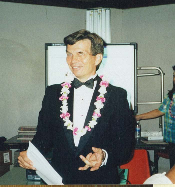
Mark Lierman was born in Twin Falls, Idaho. He worked in GIS for over 25 years, and came to the City and County of Honolulu in 1992. As a GIS Analyst with over 17 years of service and a key senior member of the City’s Department of Planning and Permitting, Honolulu Land Information System (HoLIS) program, he was a major contributor to the development of Honolulu's GIS program. He was also an instrumental leader in the development, deployment and management of the City’s building, land use, and construction permitting system known as POSSE.
Mark was a tireless advocate for and an enthusiastic promoter of GIS technology to many citizens, professionals, civil servants, and politicians throughout the State of Hawaii. He was a cheerful participant in local GIS user groups, including HIGICC, and was a fixture at GIS Day events at McCoy Pavilion. Known for his playful roles (as a butler, as a globe, etc.), he used humor and self-deprecation to put a human face to GIS and reduce the intimidation factor of the technology to make it more accessible to kids and volunteers alike.


